
Mapping Composting Infrastructure and Supporting Legislation
GreenBlue has developed several interactive maps and charts of composting infrastructure and supportive legislation in the United States, available on Tableau Public:
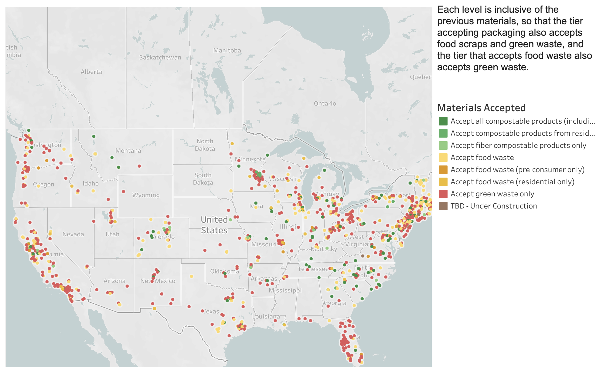
- Composting Facilities in the United States
- Food Waste Legislation
- Composting Access by Population Density of States, Counties, and Urban Areas
These maps seek to provide insight into basic questions such as where composting facilities are located in the United States and how many accept compostable packaging. Additionally, the maps display where state and local legislation has banned the disposal of food waste to landfills. Legislation that bans food waste from landfills often spurs the expansion of composting infrastructure, since composting is identified as one of several alternative pathways for food waste.
Composting access maps show composting facility locations overlaid on the United States by state and urban populations, with more densely populated areas in darker blue. Information on state and urban populations might be used to calculate residential access to composting programs. It can also be used to identify high-population cities that do not currently have sufficient access to composting infrastructure, and are therefore unable to compost food waste or compostable packaging.